Venus Unveiled: A Geospatial Approach to Mapping Volcanism on Earth’s Twin
Venus Unveiled is a StoryMap that introduces Venus, often called Earth’s sister planet, and explores how radar data from NASA’s Magellan mission continues to shape our understanding of Venusian geology. Created in preparation for my Summer 2025 internship with the Smithsonian’s National Air and Space Museum and in anticipation of the upcoming VERITAS mission, this project provides an accessible overview of Venus’ volcanic history, key geologic features, and the tools scientists use to study the planet remotely.
By integrating planetary science concepts with cartographic storytelling, the StoryMap highlights the role of geospatial technology in planetary exploration. It introduces synthetic aperture radar (SAR), discusses the significance of Venus’ global resurfacing, and outlines what future missions like VERITAS aim to uncover about the planet’s interior and surface processes.
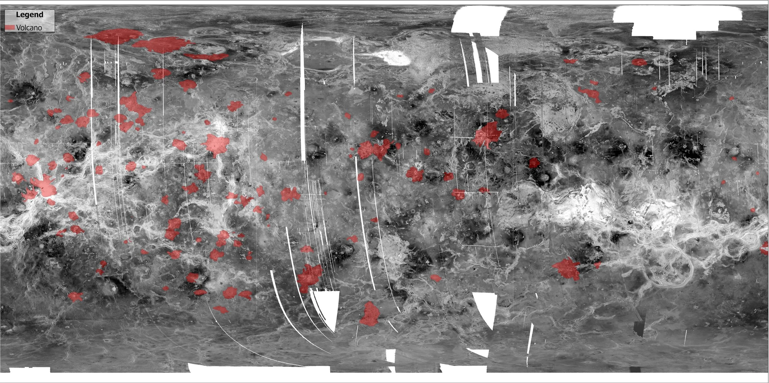
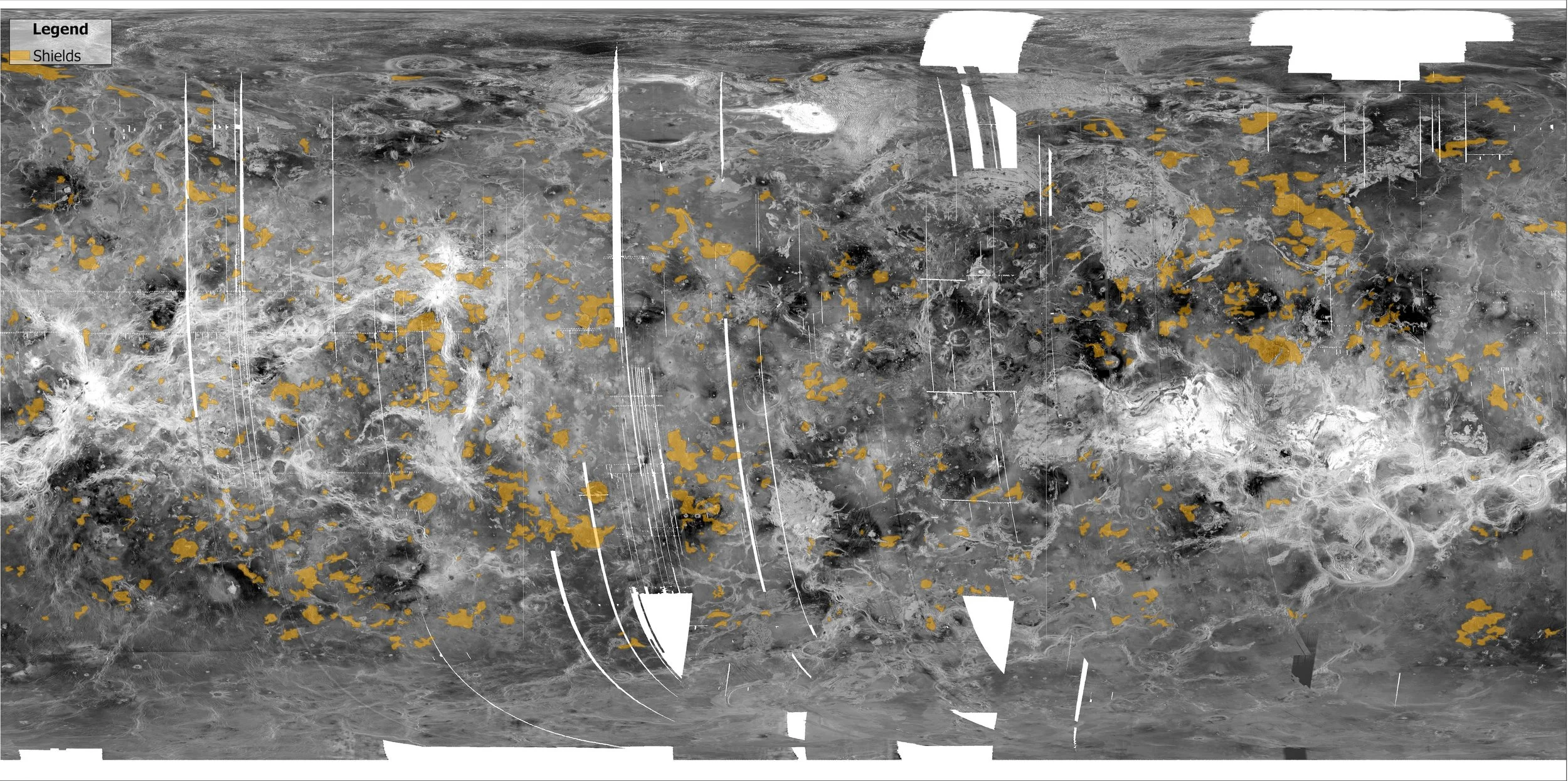
As I developed this project, I encountered limitations in translating planetary datasets into web-based mapping platforms that are largely designed around Earth-based coordinate systems. When publishing directly from ArcGIS Pro to ArcGIS Online proved incompatible with Venus’ planetary projections and caching requirements, so I adapted my approach. I exported the maps as high-resolution images, both with and without mapped volcanic features, and incorporated them into the StoryMap using swipe and slider tools. This allowed viewers to interactively compare raw radar imagery with interpreted geologic features, preserving the intent of the maps despite platform constraints.
The project ultimately serves as both an educational resource and a science communication piece aimed at making planetary geology more approachable for general audiences. It also reflects my growing interest in planetary cartography and in using GIS and remote sensing not only to analyze other worlds, but to thoughtfully design ways of sharing their stories, especially when technical limitations require creative, design-driven solutions.
Below is a selection of static maps created for this project using Magellan radar imagery and publicly available geologic shapefiles. These visuals highlight key volcanic features and surface patterns on Venus, including lava flow fields, coronae, and fracture zones. Each map was designed to complement the narrative in the StoryMap, offering a closer look at the geospatial data that helps scientists interpret Venus’ complex geologic history.