Shaky Foundations…
This was my first independent GIS research project conducted outside of a structured classroom assignment. Initially developed as a final project, the work quickly grew into a larger self-directed investigation as I became more interested in how geologic hazards and socioeconomic patterns intersect spatially in Los Angeles County.
The project examines the relationship between liquefaction hazard zones and economic vulnerability using geospatial datasets made available through the Los Angeles County GIS Data Portal. While the socioeconomic data were pre-processed and publicly accessible, the analytical challenge lay in deciding how to meaningfully integrate these datasets, evaluate spatial relationships, and design maps that clearly communicated patterns of risk.
Using ArcGIS Pro, I developed an independent workflow that combined liquefaction hazard layers with per capita income data, focusing on classification, symbology, and layout choices that emphasized visual clarity and interpretability. Because this project was not tied to a prescribed assignment structure, I made deliberate cartographic decisions about scale, color ramps, and data representation, refining the maps through multiple iterations as my understanding of the spatial patterns deepened.
What began as a single course project ultimately became the foundation for continued research and conference presentations. Shaky Foundations marked an important turning point in my academic development, helping me build confidence as an independent student researcher and shaping my interest in using GIS and cartography to explore questions of hazard exposure, equity, and community resilience.

Final Poster Presented at the APCG Conference in Arcata, CA - October 2024
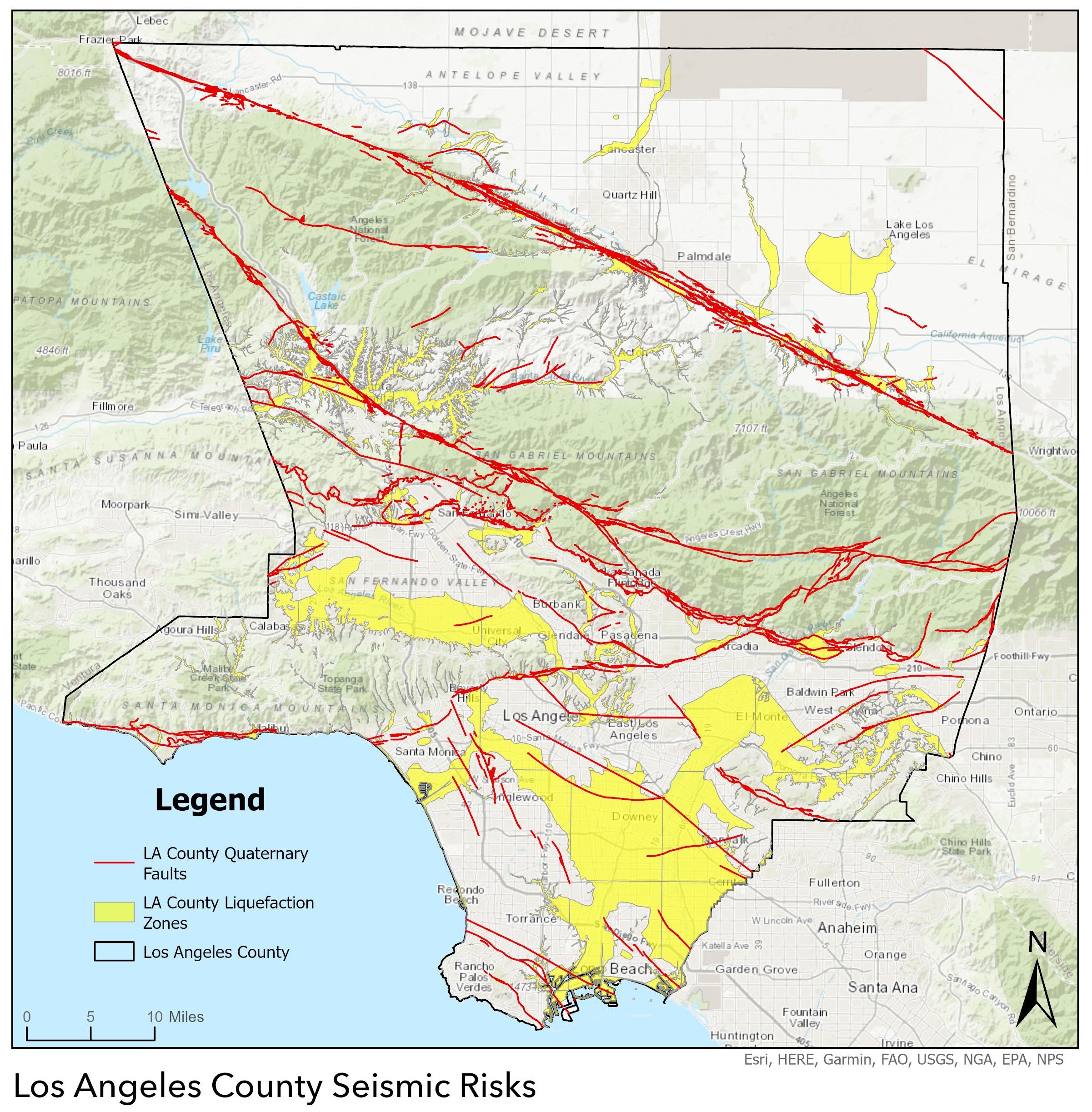
Los Angeles Seismic Risks Map
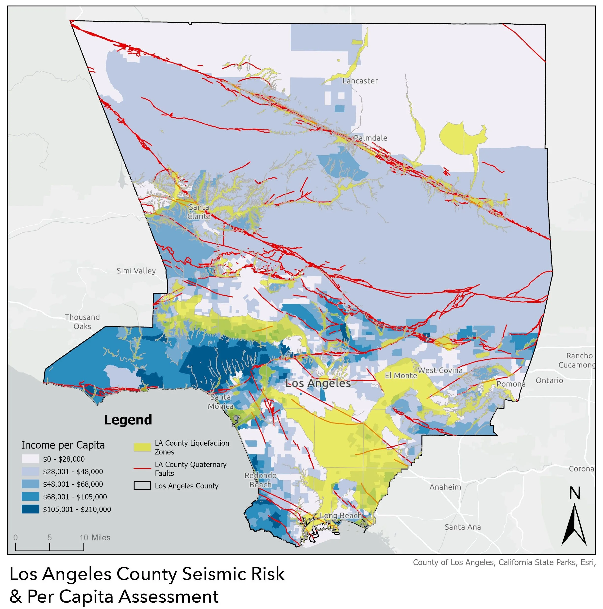
Los Angeles County Seismic Risk/Per Capita Income Spatial Analysis Map