Shaky Foundations: Exploring the Spatial Relationship Between Liquefaction Hazards and Economic Disparities in Los Angeles County
At the 2024 Association of Pacific Coast Geographers (APCG) Conference, I presented a GIS-based poster examining the intersection of seismic hazard and economic disparity in Los Angeles County. The project visualized liquefaction zones and Quaternary fault lines alongside per capita income data by census tract to explore how seismic risk disproportionately impacts lower-income communities. The poster aimed to communicate complex geospatial relationships in a clear and accessible way, emphasizing the importance of equitable disaster preparedness and mitigation planning. Feedback from the conference highlighted the clarity of the maps, the relevance of the topic, and the potential to expand the project to other regions.

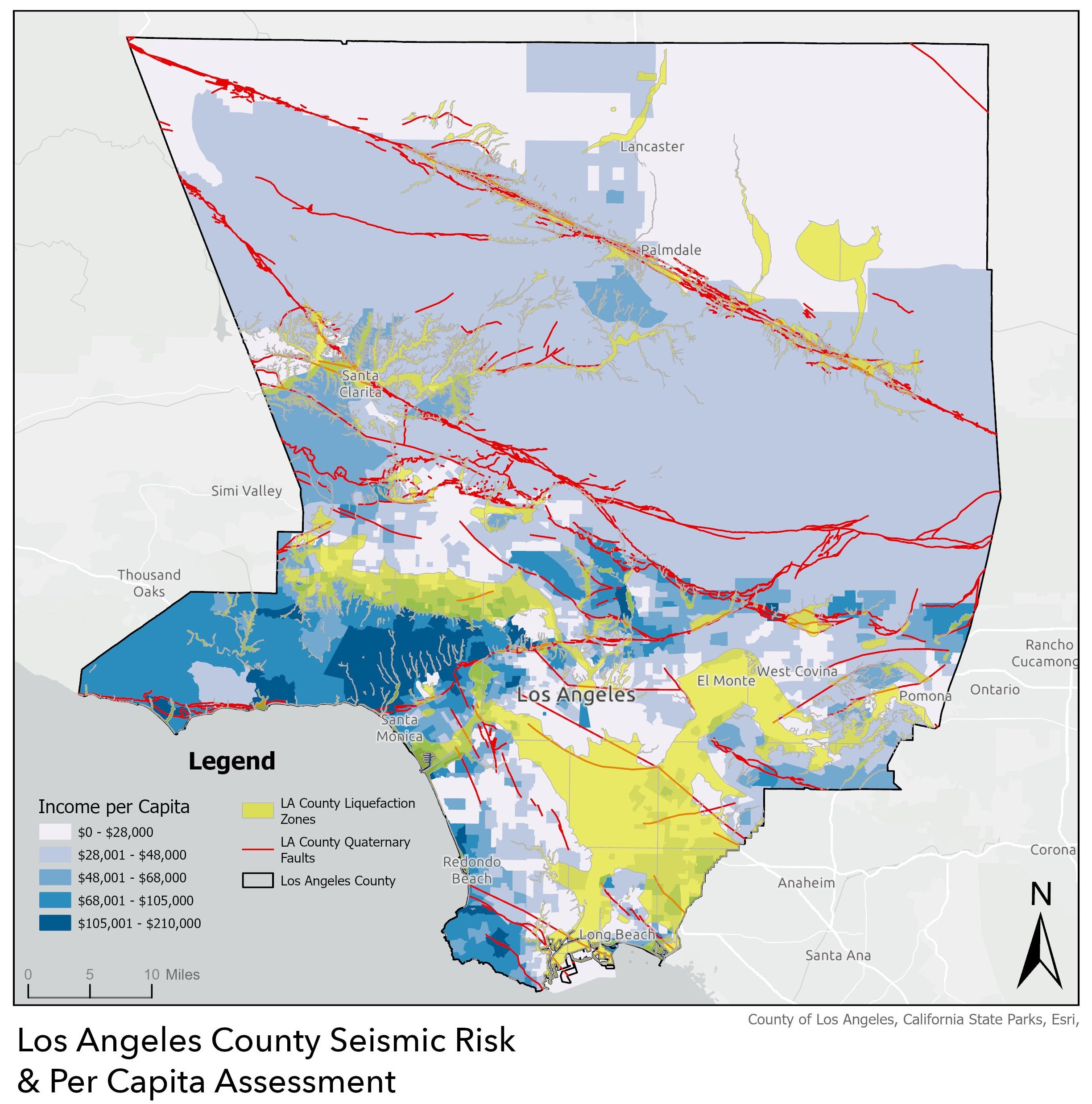

Final Poster Presented at the APCG Conference in Arcata, CA - October 2024